Drone construction monitoring in Northern Virginia
Monthly drone flights that give your superintendent, owner, and lender the same picture of the site: a dated orthomosaic, a 3D model, and earthwork quantities measured against original ground.
Get a quoteBased in Fauquier County. Flying Loudoun, Prince William, Fairfax, Stafford, and the surrounding counties.
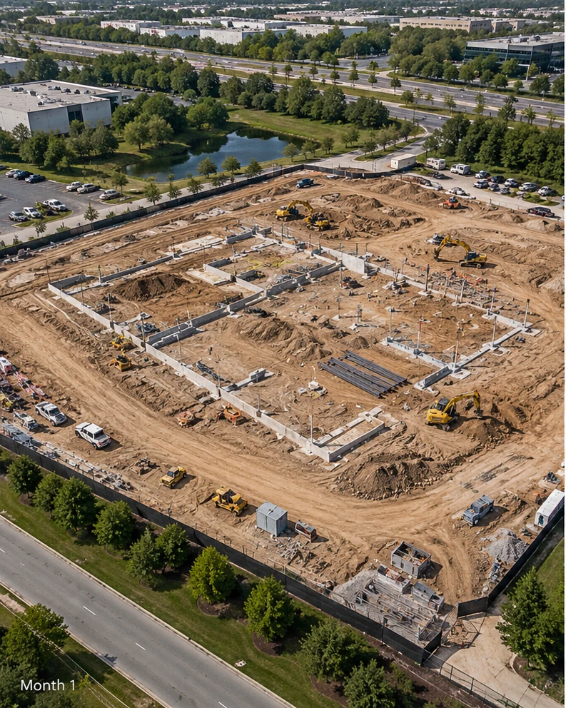 Last month
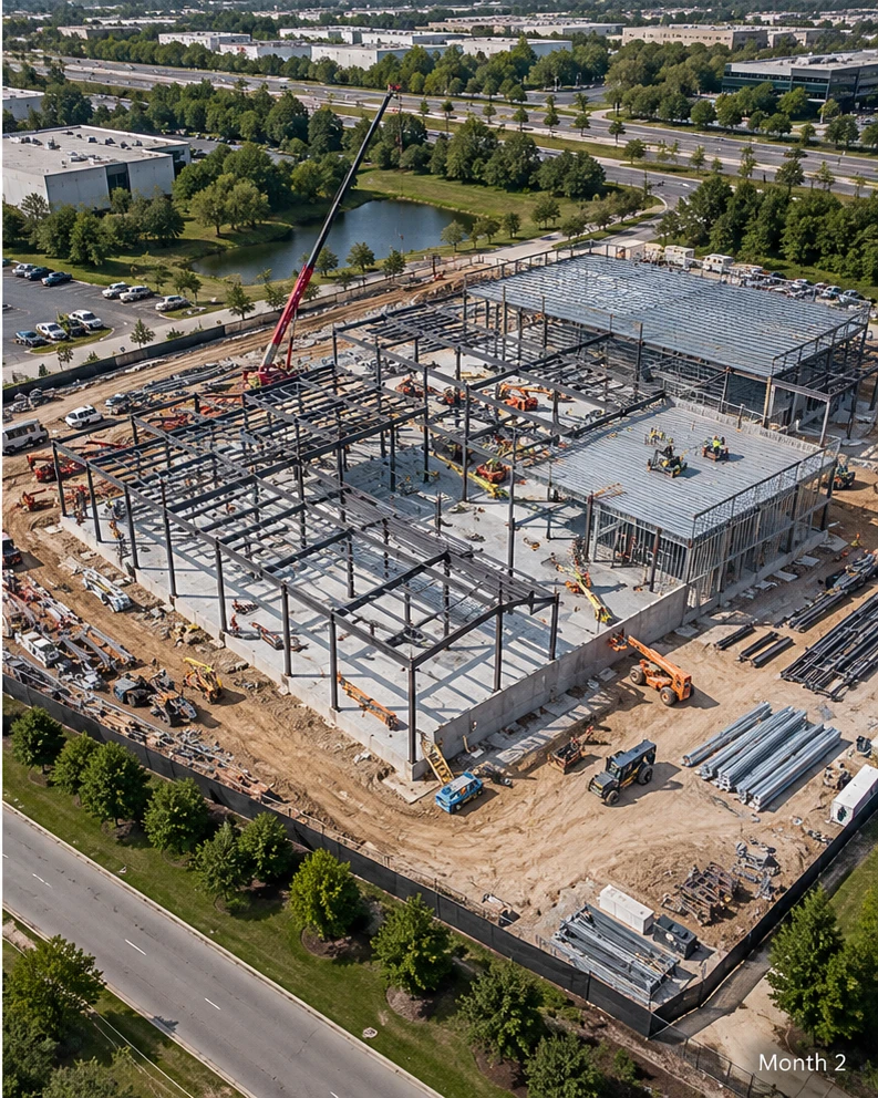 This month
What each drone flight delivers
Every visit produces the same set of files, flown on the same routes, so this month lines up with last month.
Orthomosaic
One georeferenced, map-accurate image of the whole site, dated and tied to your site control. Measure distances and areas directly on it.
3D site model and point cloud
Walk the site from your desk. Delivered as a browser link your whole team can open, plus LAS files for your engineers.
Cut and fill volumes
Earthwork quantities for the period and to date, measured against original ground or the design surface.
Progress comparison
This month next to last month, so questions about what was done and when get answered by the imagery.
Progress photos
Oblique drone photos from the same viewpoints every visit, for owner reports and marketing.
Files your team already uses
GeoTIFF, LAS and LAZ, DXF contours, and PDF reports, in your project's coordinate system.
Drone monitoring through every construction phase
What the site needs changes as the job moves. So does what we fly.
- Before clearing
Original ground
Drone LiDAR reads the ground through tree cover, setting the baseline every earthwork quantity is measured against.
- Mass grading
Cut and fill
Monthly or biweekly volumes during earthwork, checked against the grading plan.
- Vertical construction
Progress record
Monthly orthomosaics and 3D models tied to pay applications and schedule updates.
- Closeout
As-builts
Final site conditions, including the stormwater facility as-builts needed for acceptance.
Who uses construction drone data
General contractors
Verify subcontractor progress, plan site logistics, and back up pay applications with dated imagery.
Owners and developers
See every site each month without driving to it, and track progress against schedule across projects.
Construction lenders
Independent, dated verification of progress before a draw is released.
Accuracy you can check
Every flight uses RTK positioning, and we set independent checkpoints on the ground that are held out of processing. Your report states the accuracy measured against them, not a number from a spec sheet.
Same routes, same viewpoints, every visit. Flight plans are saved at kickoff and reflown each month, so every comparison lines up with the last.
Flying near Dulles and the D.C. airspace
Much of Northern Virginia sits in controlled airspace around Dulles, Manassas, and Leesburg, and parts of Loudoun, Fairfax, and Prince William fall inside the Washington, D.C. Special Flight Rules Area.
We check every site's airspace during scoping and secure FAA authorization before flight day. Sites inside the Flight Restricted Zone around the city generally can't be flown.
Questions about drone construction monitoring
How often should a construction site be flown?
Monthly is standard, timed to pay applications. During mass grading, some contractors fly every two weeks to track earthwork. We set the schedule at kickoff and fly the same routes each visit, so every month compares cleanly with the last.
How accurate is drone construction mapping?
With RTK positioning and ground checkpoints, accuracy on open ground is typically within 2 to 5 cm horizontally and vertically. Every report states the accuracy measured against checkpoints that were held out of processing.
How much does drone construction monitoring cost?
Monthly progress flights on typical sites under 50 acres usually run $600 to $1,200 per visit, depending on site size, deliverables, and whether earthwork volumes are included. Projects on a schedule of 12 months or longer are priced as a retainer at a lower per-visit rate.
How quickly do we get the data?
Orthomosaics and progress photos are typically delivered within two business days of the flight. Volume reports and 3D models follow within three to five business days.
Can you verify progress for a construction loan draw?
Yes. Each visit produces a dated orthomosaic and progress photos from the same viewpoints, which lenders and their inspectors can compare against the draw schedule. We document progress; approving a draw stays with the lender.
What site safety or badging do you need from us?
Tell us your orientation, PPE, and badging requirements during scoping. We complete any required site orientation, wear the required PPE, check in with the superintendent on arrival, and follow your site rules.
Can you fly an active site with cranes and equipment running?
Usually, yes. We coordinate launch location, timing, and crane swing with the superintendent, keep clear of crane paths, and never fly over workers who aren't part of the flight operation.
Construction sites we serve
We fly construction projects across Northern Virginia, including Loudoun, Prince William, Fairfax, Fauquier, Stafford, Culpeper, and Spotsylvania counties — from data center campuses in Ashburn and Manassas to residential developments in Gainesville, Haymarket, Warrenton, and Fredericksburg.
Get a quote for your site
Send the site address, rough acreage, and current phase. We'll reply with a flight plan and a price.
Get a quote- spencer@sandtair.com
- Phone
- (805) 814-5803
- Based in
- Broad Run, Virginia