Drone volumetrics and stockpile measurement in Virginia
Stockpile inventories and landfill airspace measured by drone in a single flight, with a number you can reconcile against the scale house and defend when corporate asks.
Get a quoteBased in Fauquier County. Flying quarries, landfills, and yards across Northern and Central Virginia.
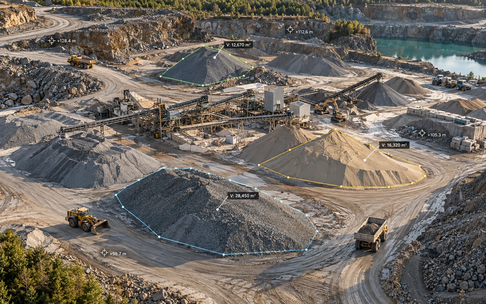
What each drone volume survey delivers
The same report every cycle, with the same pile names, so this month reconciles cleanly with the last.
Volume report by pile
Cubic yards for every stockpile, with the base surface and method stated. Tons too, if you give us a density factor for each material.
Change since the last survey
Pile-by-pile increase or decrease, ready to reconcile against production and shipped tonnage.
Labeled yard orthomosaic
A map-accurate image of the whole yard with every pile named, so everyone refers to the same pile the same way.
3D model and point cloud
A browser link anyone on your team can open, plus LAS files for your engineers.
Landfill airspace and settlement
Remaining capacity against permitted final grades, and settlement since the last survey.
Files your team already uses
PDF reports, Excel and CSV volume tables, DXF, and surfaces in your coordinate system.
What a drone stockpile report looks like
Every pile, every cycle, with the base surface and density factor stated so the numbers can be checked.
| Pile | Material | Base surface | Volume (yd³) | Change since last | Density (t/yd³) | Tons |
|---|---|---|---|---|---|---|
| P-01 | #57 stone | Lowest perimeter | 4,820 | −1,140 | 1.45 | 6,990 |
| P-02 | Crusher run | Triangulated toe | 7,315 | +620 | 1.50 | 10,970 |
| P-03 | Manufactured sand | Concrete pad | 3,960 | −410 | 1.35 | 5,350 |
| P-04 | Rip-rap | Triangulated toe | 1,275 | 0 | 1.50 | 1,910 |
| Yard total | 17,370 | −930 | 25,220 | |||
Illustrative figures. Your report uses your own pile names and density factors.
How a drone stockpile survey runs
From the first call to a number on your desk.
- Before the first flight
Scope
We agree on the pile list, density factors, reporting dates, and any site safety or MSHA training requirements.
- Flight day
Fly
A typical yard takes under an hour, with no one climbing piles. We plan flight lines around active loading and never fly over people.
- Processing
Measure
Each pile gets its own base surface, and results are checked against ground control points.
- Delivery
Report
Volume report, change summary, and labeled yard map, typically within two business days.
Who uses drone volumetrics
Quarries and aggregate producers
Month-end and fiscal-year inventory that reconciles with shipped tonnage.
Landfills and solid waste authorities
Airspace capacity, settlement, and cover volumes for permit reporting and budgeting.
Materials yards
Mulch, topsoil, salt, and fill inventory. For earthwork on active job sites, see drone construction monitoring.
Why drone volumes beat walking the piles
A GPS rover crew samples a few dozen points per pile and puts a person on an unstable slope. A drone captures millions of points across every surface of every pile in one flight.
Well-defined piles typically measure within a few percent. Most of the remaining uncertainty comes from where a pile's base is drawn, so the report shows that base for every pile.
Photogrammetry or drone LiDAR?
Bare aggregate piles are photogrammetry's best case: fast to fly and sharp to process.
Landfill slopes, vegetated piles, and anything under tree cover call for drone LiDAR, which reads the ground through vegetation. We carry both and choose per site.
Questions about drone volumetrics
How accurate is drone stockpile measurement?
Well-defined piles typically measure within a few percent of true volume. Accuracy depends mostly on how the base of each pile is defined, so every report documents the base surface used for each pile.
How much does a drone stockpile survey cost?
Most stockpile surveys run $900 to $2,500 per visit, depending on yard size and pile count. Monthly and quarterly contracts are priced lower per visit, since flight plans and base surfaces are reused.
How often should stockpiles be measured?
Most quarries and yards measure monthly or quarterly, timed to inventory closes. Landfills typically measure quarterly or annually, depending on permit and financial reporting.
Do you need to stop operations during the flight?
No. We brief the yard, plan flight lines around active equipment, and never fly over people. Most flights take under an hour.
Can you report tons instead of cubic yards?
Yes. Give us a density or bulk factor for each material, and the report converts volumes to tons and shows the factor used.
How do you measure piles against walls or in bins?
Each pile gets a base surface that fits its setting, whether that's open ground, a concrete pad, a bin, or a wall. The method for each pile is stated in the report.
Can you measure landfill airspace?
Yes. We compare the current surface against your permitted final grades to calculate remaining airspace, and against the prior survey to measure settlement. Drone LiDAR handles vegetated slopes.
Do you need MSHA training to work at a quarry?
Quarries are regulated by the Mine Safety and Health Administration, and most require site-specific hazard awareness training before a contractor goes on site. We complete whatever your site requires before flight day.
Stockpile and landfill sites we serve
We fly quarries, landfills, and materials yards across Northern and Central Virginia, including Fauquier, Prince William, Loudoun, Stafford, Culpeper, Spotsylvania, and Fairfax counties, and travel for multi-site programs.
Get a quote for your yard
Send the site location, rough acreage, number of piles, and how often you report inventory. We'll reply with a flight plan and a price.
Get a quote- spencer@sandtair.com
- Phone
- (805) 814-5803
- Based in
- Broad Run, Virginia